Main Content
Lesson 1: Overview of the Food System
The Location of Production
This part of the lesson will look at the location of production for some of the major agricultural commodities in the United States and what determines this.
According to the latest Census of Agriculture (2012) the United States has roughly 915 million acres of land in farms (370 million hectares), which is roughly 40 percent of the total land area. Cropland makes up about 43 percent of the farmland; the rest is mainly used for pasture.
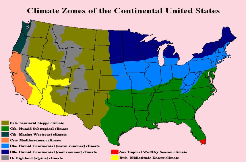
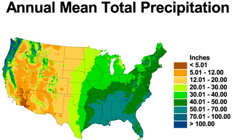
The United States is climatically diverse. In the 48 contiguous states (that is excluding Alaska and Hawaii) the climate can range from hot arid desert and semi-arid cold steppe climate and from cool humid to humid subtropical. Annual precipitation can vary across the country from less than 5 inches (13 cm.) to over 100 inches (2.5 meters).


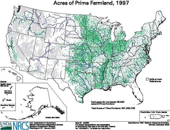
The U.S. Natural Resources Conservation Service (NRCS), which is part of the US Department of Agriculture (USDA), classifies soils into capability groupings that indicate their suitability for farming. The groupings are based upon such factors as the composition and limitations of the soils and the risk of damage when they are used. Prime farmland, as defined by USDA, is land that has the best combination of physical and chemical characteristics for producing food, feed, forage, fiber, and oilseed crops and is also available for these uses. Based on this classification, we can see that in the United States much of the prime farmland (see map) is concentrated in the Central and Eastern parts of the country. The Midwestern states of Illinois, Indiana, Iowa, Kansas, Michigan, Minnesota, Missouri, Nebraska, Ohio, North and South Dakota and Wisconsin have some of the richest soil in the United States and a very favorable climate for agriculture (good supply of moisture and warm summer temperatures).

We can see what this endowment of good soils implies by looking at the distribution of some of the major crops in the United States.
